

The gap between what modern satellite technology can deliver and what most state agencies have contracted for is the real disaster preparedness problem, and recent events are making that gap impossible to ignore.
In March of this year, Hawaii experienced one of the most severe flood events in recent history. Satellite data showed this was the most extensive multi-island flooding recorded in the state of Hawaii in recent years, spurred by back-to-back storms and prolonged rainfall, which inundated residential communities and key transportation routes.
The scale and duration of this weather event highlight a growing reality: disasters are becoming more widespread and severe. An effective response to these events requires near-real-time, always-on monitoring that provides emergency responders with the insight they need to allocate resources more effectively, make data-driven decisions, and maintain up-to-date situational awareness on the ground.
One of the companies helping to deliver the real-time intelligence governments need to respond to natural disasters is ICEYE, which leverages the world’s largest and most advanced synthetic aperture radar (SAR) satellite constellation to provide persistent monitoring capabilities to government agencies.
Government Technology Insider recently sat down with Mike Bennett, Head of Government Solutions, North America at ICEYE, to discuss their recent assistance with flood monitoring in Hawaii and how the new trends in satellite technology can transform the future of disaster preparedness.
Government Technology Insider (GTI): We’re heading into hurricane season just weeks after catastrophic flooding in Hawaii. What does this recent disaster reveal about how extreme weather events are changing?
Mike Bennett: States need to recognize that disasters are increasing in both frequency and severity. We are seeing what were once considered 100-year or even 500-year flood and fire events repeatedly occurring in the same states.
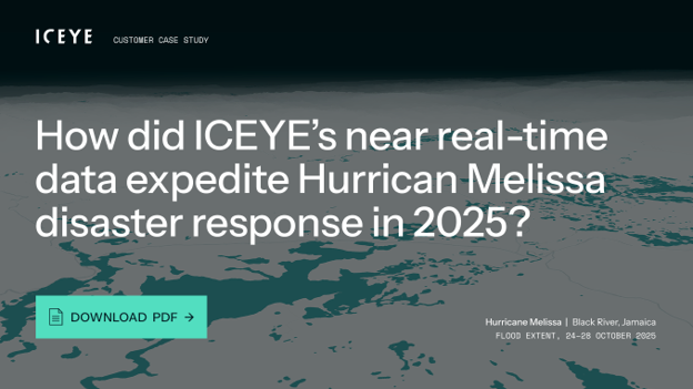
Seemingly every year, hurricanes in the United States and the Caribbean reach Category 5 intensity and, in some cases, approach the physical limits of what storms can become – like Hurricane Melissa in 2025. At the same time, wildfires are emerging in areas previously considered low risk, and both flash and riverine floods are occurring in regions that historically were not even seen as flood prone.
The reality is that everyone is now at risk for some form of disaster.
GTI: The recent flooding in Hawaii caught many by surprise. Where are the biggest disaster preparedness gaps today in how we monitor and anticipate flood risk in near real time?
Mike Bennett: The United States has invested heavily in flood sensors, gauges, and modeling systems, but it is a vast country with diverse risks. Monitoring every location effectively remains a challenge.
In a disaster like the flooding in Hawaii, several limitations became clear. Much of the flooding occurred overnight, when visibility was low. Some river and stream gauges were damaged or washed away during peak conditions. The communication infrastructure was also impacted, limiting the ability to transmit data in real time.
Traditional aerial assessment methods also fall short in these scenarios. Aircraft and helicopters cannot see through cloud cover, and they are ineffective at night. As a result, responders often lack a complete picture of what is happening on the ground when they need it most.
This is where space-based technology becomes essential. Satellite systems using Synthetic Aperture Radar (SAR) can capture conditions as they unfold, regardless of weather or lighting.
GTI: For those unfamiliar, what is SAR, and how can SAR satellite systems be used in events like the Hawaii floods?
Mike Bennett: Satellite-based hazard monitoring uses orbiting systems to observe and analyze conditions on Earth during disasters. Commercial SAR satellite constellations provide continuous, always-on monitoring and can be tasked in near real time.
Because it is cloud-penetrating, the ICEYE imagery flood extent product was the first remotely sensed data available. For this reason, it was used to delineate the extent of the inundation and was crucial to planning both debris cleanup and coordinating damage assessment teams. ICEYE’s estimates of the flood depths for impacted structures provided important context about where the damage would be the most severe. Between the timeliness of the data and the unique capabilities of SAR collections, the flood product definitely punches above its weight. If you are an emergency manager living anywhere that has a hurricane season you need to consider something of this nature.” – Rod Low, TA GIS Administrator, Honolulu Land Information System, Department of Planning and Permitting, City and County of Honolulu
For emergency managers, this means actionable situational awareness during the exact window of need, whether that be overnight, cloud-covered, or fast-moving when traditional methods go dark.
GTI: How can satellite data improve situational awareness for emergency responders on the ground?
Mike Bennett: With continuous monitoring, satellite data collection begins before the disaster fully unfolds. Teams track weather patterns, reports, and other indicators to anticipate where impacts will be most severe – and then adjust as the event unfolds.
Satellite data provides responders with clear, visual information about where flooding is occurring and how it is evolving. This includes insights into water extent and depth, and the associated potential damage, such as impacts on buildings and infrastructure.
This level of visibility allows emergency responders to prioritize resources, direct rescue teams to the hardest-hit areas, and coordinate recovery efforts more effectively.
GTI: Looking ahead to hurricane season, how can satellite-based monitoring help state and local governments with disaster preparedness?
Mike Bennett: Leveraging historical observational SAR data can give states a more accurate understanding of what has happened in past events. This creates a reliable dataset that can be used to improve planning and response models.
Pre-disaster contracts can then ensure that agencies are already onboarded with technology providers, enabling them to access data immediately in the event of an emergency. This eliminates delays associated with procurement, onboarding, and training.
Agencies with existing subscriptions can access critical data faster and respond more effectively.
GTI: After a disaster strikes, like in Hawaii, what role does satellite data play in recovery?
Mike Bennett: Satellite data plays a central role in damage assessment and recovery planning. It helps identify where impacts occurred, what resources are needed, and where recovery teams should be deployed. By quickly understanding the extent of damage, agencies can prioritize aid, allocate resources efficiently, assess total damage, and begin rebuilding efforts sooner. This accelerates the recovery process and helps communities return to normal more quickly.
Most importantly, satellite data provides a broader and more consistent view than ground-based data alone, which may be limited or disrupted during a disaster.
GTI: We’ve seen agencies like FEMA use commercial satellite data in past disasters. How has this kind of data changed disaster preparedness, and how might its role expand in the future?
Mike Bennett: Commercial satellite data has fundamentally changed how decisions are made during disasters. At ICEYE, the focus is not just on delivering imagery, but on delivering actionable insights. Advances in small satellite technology and increased access to space have significantly improved visibility into real-world conditions. Geospatial analysis of the imagery itself is central to enabling expedited damage assessments, rapid flood extent mapping, and integration with existing government data platforms and emergency operations center systems.
For example, just last year ICEYE released a machine learning-powered technology called Flood Rapid Impact Product (FRI) to revolutionize response. FRI delivers detailed floodwater extent based on observational data within approximately 6 hours of the first signs of an event. The speed and accuracy of FRI provide users with a new level of actionable flood intelligence, enabling more informed, immediate decision-making that can be integrated into their government data platforms.
Today, there are more satellites collecting data than ever before. While this creates opportunities, it can also lead to information overload. The challenge is not just access to data, but the ability to interpret it quickly.